


BAKERS CORNER, Hamilton County, Indiana
About
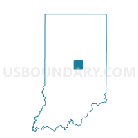
Outline

Summary
| Unique Area Identifier | 577488 |
| Name | BAKERS CORNER |
| County | Hamilton County |
| State | Indiana |
| Area (square miles) | 11.35 |
| Land Area (square miles) | 11.33 |
| Water Area (square miles) | 0.02 |
| % of Land Area | 99.83 |
| % of Water Area | 0.17 |
| Latitude of the Internal Point | 40.13784700 |
| Longtitude of the Internal Point | -86.15177350 |
Maps


Graphs
Select a template below for downloading or customizing gragh for BAKERS CORNER, Hamilton County, Indiana


Neighbors
Neighoring Voting District (by Name) Neighboring Voting District on the Map
- BOXLEY, Hamilton County, IN
- DEMING, Hamilton County, IN
- HORTON, Hamilton County, IN
- SHERIDAN 02, Hamilton County, IN
- SHERIDAN 03, Hamilton County, IN
- SOUTHWEST ARCADIA, Hamilton County, IN
Top 10 Neighboring County Subdivision (by Population) Neighboring County Subdivision on the Map
- Washington township, Hamilton County, IN (32,884)
- Jackson township, Hamilton County, IN (10,368)
- Adams township, Hamilton County, IN (4,858)
Top 10 Neighboring Unified School District (by Population) Neighboring Unified School District on the Map
- Westfield-Washington Schools, IN (32,884)
- Hamilton Heights School Corporation, IN (12,854)
- Marion-Adams Schools, IN (6,091)
Top 10 Neighboring State Legislative District Lower Chamber (by Population) Neighboring State Legislative District Lower Chamber on the Map
- State House District 39, IN (76,305)
- State House District 32, IN (63,192)
- State House District 35, IN (62,848)
Top 10 Neighboring State Legislative District Upper Chamber (by Population) Neighboring State Legislative District Upper Chamber on the Map
Top 10 Neighboring 111th Congressional District (by Population) Neighboring 111th Congressional District on the Map
Top 10 Neighboring Census Tract (by Population) Neighboring Census Tract on the Map
- Census Tract 1103, Hamilton County, IN (12,100)
- Census Tract 1105.07, Hamilton County, IN (10,869)
- Census Tract 1102.01, Hamilton County, IN (4,363)
- Census Tract 1104.01, Hamilton County, IN (3,917)